Explore our historic railway route, museum location, stations, and points of interest along the 10-mile stretch between Waterville and Grand Rapids, Ohio. This custom map shows detailed markers, the rail line, and more.
How to Use This Interactive Map
This custom map is easy to use on both desktop computers and smartphones. Full navigation controls are built-in for a smooth experience:
- Zoom In/Out: Click the + and – buttons (usually in the bottom-right corner). On mobile devices, pinch with two fingers to zoom.
- Pan / Move Around: Click and drag the map with your mouse (desktop), or swipe with one finger (smartphone/tablet).
- View Point Details: Click or tap any marker, icon, or colored line — a pop-up will appear with photos, descriptions, historical notes, or other info about that location (e.g., museum, stations, bridges, depots).
- Explore Layers: Look for the layers icon (often top-left or sidebar). Click it to show/hide different categories like railway route, points of interest, parking, or other features. Turn layers on/off to focus on what interests you.
- Fullscreen Mode: Click the expand/fullscreen icon (usually top-right) to make the map larger — great on phones or tablets.
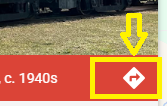
- Get Directions: Use the directions icon (arrow) to plan your route to the museum or any marker on the map.
Referencing the Legend / Key
The legend explains the colors, symbols, and layers used in this custom map:
- Click the layers/menu icon (typically top-left) to open the sidebar — the legend is usually there or at the bottom of the layers list.
- It shows what each color means (e.g., blue line = main railway track, red pins = stations, green icons = scenic spots or parking).
- Each layer/category has its own title and may include a small key or description — expand sections to see details.
- Tap or hover over symbols in the legend for quick explanations.
Coming Soon: QR Codes on Outdoor Assets
We are excited to announce that we are planning to add QR codes to many of our outdoor railway assets, rolling stock, structures, and points of interest around the property. When you scan one with your smartphone camera:
- You’ll instantly access a detailed profile page for that specific asset — including history, photos, technical specs, restoration status, and fun facts.
- No app download required — just open your phone’s camera and point it at the QR code.
This feature is currently in development and will be rolled out in phases to enhance your educational experience during visits.
Interested in knowing when the QR codes will be installed on specific assets or the full rollout timeline? Feel free to reach out to us directly:
Tip: On smartphones, rotate to landscape mode for better map visibility and easier control access. Zoom out a bit if controls feel crowded. Questions about the map, QR codes, or your visit? Call us at (419) 878-2177 — we’re here to help!
Custom interactive map powered by Google My Maps • Zoom, pan, layers, and marker info should appear automatically. If controls are not visible, try zooming out or refreshing the page.